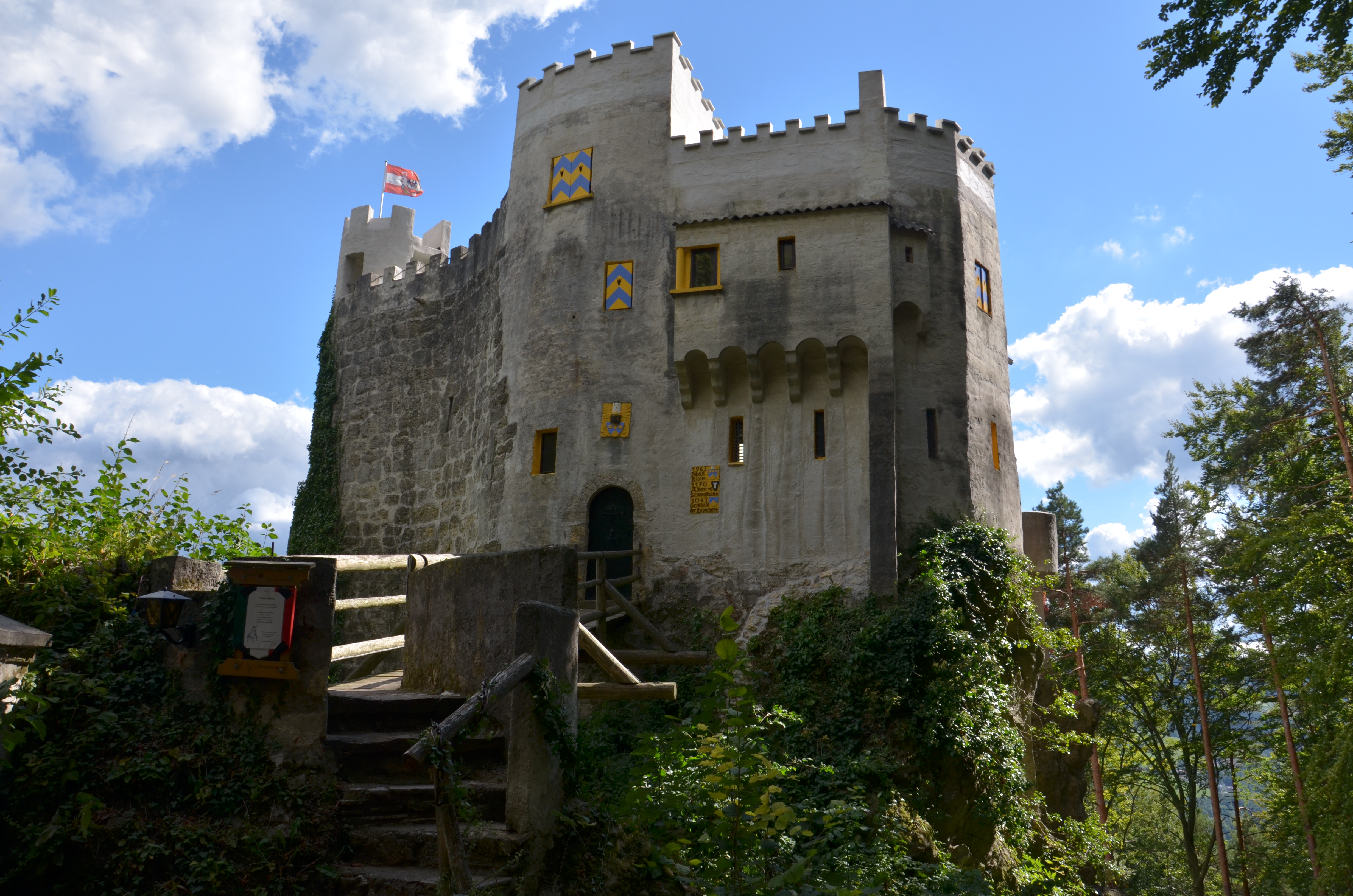
Castle path Grimmenstein

Hiking tour Starting from Grimmenstein town hall square
A beautiful loop trail through the forest, via the Kulmriegel to Grimmenstein Castle—open to the public
A beautiful loop trail through the forest, via the Kulmriegel to Grimmenstein Castle—open to the public
The castle trail starts at Rathausplatz (parking is available right there or at the Edlitz-Grimmenstein train station) and heads toward Kunstgraben; from there, it follows a forest path up Grimmenstein’s local mountain—the Kulmriegel—toward the castle. It’s worth making a quick stop at the Mariengrotte, a site of Marian devotion with places to rest. From spring through winter, you can stop for a break at the castle. There, you can enjoy drinks and light snacks on the terrace, which offers a view of the Pittental valley. The trail continues under the cooling canopy of trees up to the Eben, and from there back downhill to Rathausplatz.
For information on admission prices and opening hours, visit: www.burg-grimmenstein.at
Your hikes in the Vienna Alps should be a completely beautiful and safe experience. Please therefore observe the following:
Preparation
Make sure when choosing the route that it matches your experience and fitness. Inform yourself in advance about the weather report. The weather in the mountains can change surprisingly quickly. Therefore, always set out appropriately equipped (e.g. rain protection).
Check whether the huts and snack stations you want to visit on the way are open. Inform someone about your choice of route and your planned return before you set off.
More safety tips for your hike can be found here.
Always take suitable maps with you. Wear sturdy shoes suitable for the route, bring sun and rain protection as well as water and a snack. Take your mobile phone and save the emergency numbers of rescue services: Rescue 144 / Mountain rescue 140
Signage G1 (large Kulmriegel route), then G1a (Castle path)
Start at Grimmenstein town hall square, then the path leads along Schulgasse towards Kulmriegel, with the castle already visible in sight. Then go left up into the Kunstgraben, where after the bridge take the right turn towards the grotto into the forest. Follow the markings G1 to the grotto, before the settlement "Grün" turn left towards the castle (G1a). Past the hunting hut, shortly before the settlement Eben turn left into the Kunstgraben. Return to Schulgasse and to the town hall square.
Free parking either directly at the town hall square or at Edlitz-Grimmenstein station.
Take the Grimmenstein exit from the Southern motorway and then turn right into the town center.
Edlitz-Grimmenstein Train Station—the hike begins about 200 meters from the station.
Alternatively, the town is also easily accessible by bus.
For more information, visit www.oebb.at and www.vor.at
Places of Interest: Grimmenstein Castle (also offers refreshments and guided tours on weekends), Mariengrotte
Places to Stop for Refreshments: Pizzeria Grimmenstein, Gasthof Pichler in Petersbaumgarten (overnight stays also available), and tavern Zierhof
Leider können wir Ihnen zum jetzigen Zeitpunkt keine Wetterdaten für den Ort anzeigen.
Vienna Alps in Lower Austria, www.wieneralpen.at, +43 2622 78960
Opening hours: Mon - Thu 08:30 - 16:00 / Fri 08:30 - 13:00
Letzte Änderung: 1 Oct 2026