Around the Bright Egg
Hiking tour Starting from Lichtenegg Town Hall/Wehrkirche
Walking time approx. 4 hours (16 km): Lichtenegg - Pengersdorf - Steinegger - Spratzau - Steinegger - Pesendorf - Kaltenberg - Wieden - Lichtenegg
Walking time approx. 4 hours (16 km): Lichtenegg - Pengersdorf - Steinegger - Spratzau - Steinegger - Pesendorf - Kaltenberg - Wieden - Lichtenegg
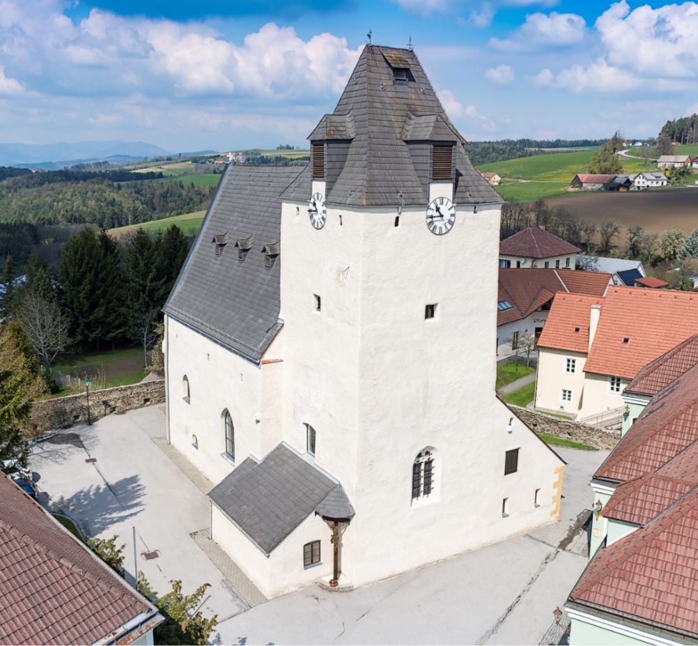
The municipality of Lichtenegg is located at 770 m above sea level, in the heart of the Bucklige Welt and offers a wide range of activities for young and old on an area of over 35 km². Be it the variety and quality of our regional products, the delicacies of our inns or the beauty of our nature - Lichtenegg is always worth a visit.
The place name Lichtenegg is derived from "lichtes Eck" (light corner), an outcrop of land exposed to the sun. The name goes back to the time of clearing and the first settlements. The name was first mentioned in a document in 1252: de Lihteneck.
We want your hikes in the Vienna Alps to be an enjoyable and safe experience in every way. Therefore, please note the following:
Preparation
When choosing a route, make sure it matches your experience and fitness level. Check the weather forecast in advance. The weather in the mountains can change surprisingly quickly. Therefore, always set out with the appropriate gear (e.g., rain gear).
Check to see if the huts and snack bars you plan to visit along the way are open. Let someone know your route and your planned return time before you set out.
Wear appropriate clothing and sturdy shoes. Be sure to bring rain and sun protection. Bring plenty to drink.
Always bring appropriate maps with you. Wear sturdy shoes suitable for the hike, and bring sun and rain protection, as well as water and a light snack. Bring your cell phone and save the mountain rescue emergency number: 140
Follow the orange markers
Parking is available at the municipal office
From Vienna: Take the A2 Südautobahn toward Graz, take the Grimmenstein exit, turn right onto the B54, turn left after the highway bridge, and follow the road (Kienegger Straße, L4106) through Kienegg and Maria Schnee; turn right at the T-intersection and follow the road to the Lichtenegg municipal office.
From Graz: Take the A2Südautobahn toward Vienna, take the Grimmenstein exit, turn right onto the B54, turn left after the highway bridge, and follow the road (Kienegger Straße, L4106) through Kienegg and Maria Schnee; turn right at the T-intersection and follow the road to the Lichtenegg municipal office.
Directions by train and bus: Take the Südbahn to Wiener Neustadt, then transfer to the regional train (toward Aspang-Markt) to the Edlitz-Grimmenstein station. From there, take regional bus 389 to the Lichtenegg Ortsmitte stop.
For more information, visit www.oebb.at or anachb.vor.at.
Guided tours of the fortified church and up to the pulpit of the Windrad are highly recommended (advance registration required).
At the self-service village store , you can find a wide variety of regional products (groceries, sweets, decorations, and small plants). In 2023, it was voted the best regional store in the area in the self-service category.
You can also buy many specialties at the Mandl Goat Farm or get a glimpse into farm life at the Ziegenpanorama.
Places to stop for a bite:
Leider können wir Ihnen zum jetzigen Zeitpunkt keine Wetterdaten für den Ort anzeigen.
More information:
Vienna Alps in Lower Austria, www.wieneralpen.at, +43 2622 78960
Bucklige Welt South Adventure Region, www.buckligewelt.info, +43 676 3509806
Municipality of Lichtenegg, +43 2643 2209
Letzte Änderung: 4 Aug 2026