alpannonia - Regional Route: Stadtschlaining - Goberling

Praktische Tipps für ein sicheres Naturerlebnis
Hiking tour Starting from Entrance to the castle, Rochusplatz
Passing Schönau and the former antimony mine, this trail takes us from Stadtschlaining to the main alpannonia trail in Goberling
Passing Schönau and the former antimony mine, this trail takes us from Stadtschlaining to the main alpannonia trail in Goberling
Hiking gear: sturdy shoes, clothing appropriate for the weather,
Don't forget to bring food!
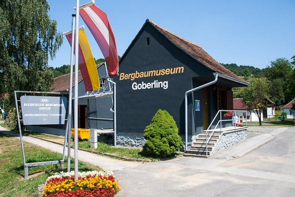
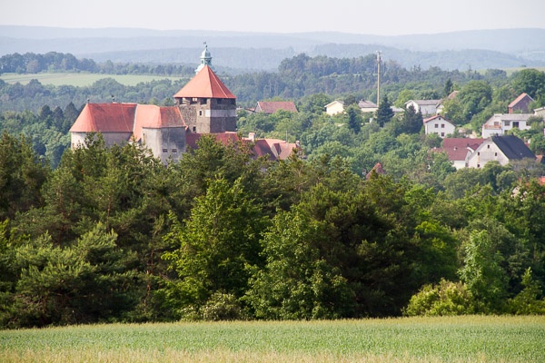
We use the terrace in front of the castle entrance, with its Alpannonia information panels, as the starting point for our tour, and descend into the moat. We keep to the left the entire time, pass through a small archway in a section of the castle wall, and follow a short, narrow trail to the base of the mountain. At the road, we keep to the right until we reach the turnoff for Schönau. We turn left up this road, but at the first hairpin curve, we follow the forest trail straight ahead. The path climbs steadily; it’s worth glancing back now and then to admire Stadtschlaining with its two churches and the towering castle from up here. The trail splits at a public works yard. A path to the right leads to Hirschenstein. We, however, head left through the Kurtwald forest toward Goberling. After a while, we reach the antimony mining site, which we cross, and then follow another forest trail through the woods. Finally, we reach a bridge at the entrance to Goberling and follow the main street into the center of town. Right next to the mining museum, we meet up with the main Alpannonia trail.
Parking available in front of Schlainig Castle
Train service to Pinggau/Friedberg, then transfer to the bus to Oberwart
Bus service from Graz/Vienna to Oberwart
Bus from Oberwart to Stadtschlaining
Schlaining Castle with the University of Peace
Peace Library and former synagogue
Three-sided city wall
Mining Museum in Goberling
Leider können wir Ihnen zum jetzigen Zeitpunkt keine Wetterdaten für den Ort anzeigen.