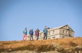
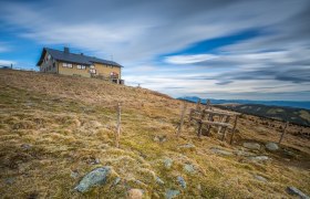
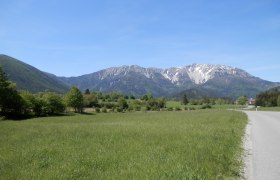
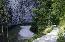
The 12th stage of the Viennese Alps Way (WAB) is accompanied by alpine grasslands, mountain pines, and rugged but safe terrain. This is a wonderful plateau hike with moderate ascents and descents. The path into the valley can be shortened with the Rax cable car.
Description
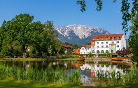
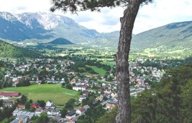
Starting from the Habsburghaus, this stage mainly covers natural hiking routes, paths, and ascents via the Trinksteinsattel, the Hohe Kanzel, the Jakobskogel. It then continues steeply downhill from the Otto-Haus but becomes more gradual on the way to Hirschwang, Reichenau, and Payerbach. Glorious views appear along the whole stretch, and when descending there are great views of villas and the gardens of Castle Wartholz.
Once at the Ottohaus, there is an option to use the Rax cable car and to use the cable car to tackle the descent instead of going down on foot. When arriving at the bottom, follow the Wasserleitungsweg route to Reichenau.
Starting point of the tour
Habsburghaus
Destination point of the tour
Reichenau an der Rax/Payerbach, railway station
Route description WAB - Stage 12: Habsburghaus - Reichenau/Payerbach
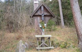
We start the stage over the Rax plateau at the Habsburgshaus, starting on path 44 heading towards Seehütte cabin and the Rax Aerial Ropeway. We then cross the Jahnkreuz and hike on paths through pine woods to the Trinksteinsattel close to the Bergrettungshütte rescue cabin. It is possible to stay in the hut in the case of an emergency. We descend 200 metres to the Neuen Seehütte cabin and the vantage point. At this point we start ascending with grand views of the Kammweg route and the Preinerwandkreuz. The Kammweg to Otto-Schutzhaus, marked out in blue, offers better views but is narrower in places whilst not being exposed. The Seeweg route, marked in red, is also an alternative route to the Otto-Schutzhaus. We cross the terrace at Otto-Schutzhaus and head into an extended right-hand bend where the Törl becomes visible and start the descent on the Törlweg path. The Törlweg, which offers plenty of grand views and is not exposed, leads us downhill through several hairpin bends. We continue somewhat further than the signposts on the way to Hirschwang and Edlach and hike past the Lammelbründl. We descend towards Knappenhof and go past it on the left onto a meadow path whilst descending further. After a few minutes we come to a crossroads. We turn left towards Hirschwang, then after a few metres we turn right onto a hiking path, marked in red, in the direction of Hirschwang-Erlangerkreuz.
The forest path turns into a paved road which leads us to a residential area. We turn right into Trautenbergstraße then when on the Bundesstraße turn right in the direction of Reichenau. We reach the centre of Reichenau after approximately half-an-hour.
If continuing to Payerbach:
Turn right into a car park shortly after passing the Kurtheater Reichenau. We cross the car park and turn left onto Promenadenweg alongside the Schwarza river. At the viaduct we come back onto a road and carry on along this towards the village centre. After going past the open-air pool and the pavilion, we turn left over the Schwarza bridge and cross over the Bundesstraße. The last stage involves walking uphill along the Bahnhofweg to Payerbach-Reichenau railway station.
Directions
The Habsburghaus is in alpine surroundings and can only be reached directly on foot. If possible, use the previous stage between Prein - Habsburghaus to reach this area.
Parking
Car parking is available at the Raxalpenhof in Prein and at the valley station of the Rax Aerial Ropeway.
The Habsburghaus is in alpine surroundings and cannot be reached directly with public transport. It is recommended to combine this hike either with the previous Prein-Habsburghaus route or the subsequent Reichenau- Knofeleben route. Take the train via Wiener Neustadt to Payerbach-Reichenau railway station. Continue with either the 1746 or 1748 regional bus to the Rax Aerial Ropeway, then use that to reach the Rax.
More information can be found at www.öbb.at and www.raxalpe.com
Author's tip
Bitte erkundigen Sie sich vor Ihrem Tourenstart hier bezüglich der aktuellen Öffnungszeiten des Habsburghauses!
